Weather


that is horrible. would homeowner's cover any of that or do you need flood insurance ?
Covered thank God
CaptainOriginal Crew4,960 postsSince 2019
What is crazy is that we normally get 3 to 4 inches of rain in a month. Central park had 3.14 in one hour. A months worth of rain in an hour. That is why a flash flood emergency was issued.
CaptainOriginal Crew4,960 postsSince 2019
Covered thank God
Better check your policy there Mr BM
Basement flooding in any way from rain flood or surface water which this event was is absolutely NOT covered on a standard homeowners policy
At least I'm enjoyin' the ride.....
CommodoreOriginal Crew7,065 postsSince 2018
that is horrible. would homeowner's cover any of that or do you need flood insurance ?
The answer is NO
Homeowners basic policy does not cover that
Flood usually does not cover damages below grade
At least I'm enjoyin' the ride.....
CommodoreOriginal Crew7,065 postsSince 2018



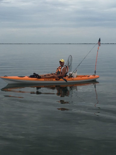

and I decided to polyurethane the doorframes, the new window, put the pool vac in, trim the backyard, go to Home Depot, etc. Along with the breeze that should reappear soon, this is not my kind of weather to go for Mr. Weak from Mr. Kayak. I am most definitely a warm weather kayakfisherman.
Every day is Saturday.
CommodoreOriginal Crew7,034 postsSince 2018
thunderin' up a storm here - heavy rain & wind as well - wondering if this has anything to do with Larry?
If I'm reading this correctly - it seemed to be a little south & very east of me @ 2 pm
"Well, it's alright.
.............even if you're old and gray."
"Well, it's alright.
............you still got something to say."
.............even if you're old and gray."
"Well, it's alright.
............you still got something to say."
AdmiralOriginal Crew20,900 postsSince 2018
[HEADING=2]Weather Alerts-Onancock, VA[/HEADING]
[HEADING=2]Special Marine Warning from WED 3:51 PM EDT until WED 5:45 PM EDT[/HEADING]
1 of 4
[HEADING=3]Action Recommended[/HEADING]
Avoid the subject event as per the instructions
[HEADING=3]Issued By[/HEADING]
Wakefield - VA, US, National Weather Service
[HEADING=3]Affected Area[/HEADING]
Chesapeake Bay from Smith Point to Windmill Point VA
[HEADING=3]Description[/HEADING]
The National Weather Service in Wakefield has issued a Special Marine Warning for...
Chesapeake Bay from Smith Point to New Point Comfort VA...
Coastal Waters from Fenwick Island DE to Parramore Island VA 20 to 40 NM... Coastal Waters from Parramore Island to Cape Charles Light VA out 20 NM... Until 545 PM EDT.
At 349 PM EDT, strong thunderstorms were located along a line extending from near Crisfield to Onancock Inlet to The Cell, moving east at 35 knots. HAZARD...Wind gusts to 40 knots. SOURCE...Radar indicated.
IMPACT...Small craft could be damaged in briefly higher winds and suddenly higher waves. strong thunderstorms will be near... Onancock Inlet, Crisfield, Lower Bernard Island and Watts Island around 355 PM EDT.
Quinby Inlet and Parramore Island around 425 PM EDT. Assateague Beach and Wachapreague Inlet around 430 PM EDT. Chincoteague Bay and Wachapreague Reef around 435 PM EDT. Chincoteague, Blackfish Reef and Bone Wreck around 440 PM EDT. African
Queen Wreck around 510 PM EDT. Jackspot Reef around 520 PM EDT. Parking Lot around 530 PM EDT.
PRECAUTIONARY/PREPAREDNESS ACTIONS... Move to safe harbor until hazardous weather passes. HAIL...0.00IN; WIND...40KTS
[HEADING=2]Special Weather Statement until WED 4:30 PM EDT[/HEADING]
[HEADING=2]Beach Hazard Statement until THU 8:00 PM EDT[/HEADING]
[HEADING=2]Small Craft Advisory until THU 4:00 AM EDT[/HEADING]
[SIZE=4][COLOR=rgb(0, 0, 0)][/COLOR][/SIZE]
"Well, it's alright.
.............even if you're old and gray."
"Well, it's alright.
............you still got something to say."
.............even if you're old and gray."
"Well, it's alright.
............you still got something to say."
AdmiralOriginal Crew20,900 postsSince 2018
its getting darker early now, we halfway tru the shorter days now till Christmas, 3 more months to go, LOL... cellfish...
luv that….closer to snow
Live and Let Fish
Good things come to those who bait.
Good things come to those who bait.
CommodoreOriginal Crew16,184 postsSince 2018
Sign in to reply to this thread.
Thread
Weather