Interesting thanks... cellie...
Weather
Looks like like some peeps or 1 peep in particular around here may wanna pay attention to these new Key messages from the NHC website. 8-)
Key Messages:
1. Life-threatening storm surge and dangerous winds are expected
along portions of the Florida east coast and the coasts of Georgia,
South Carolina, and North Carolina, regardless of the exact track of
Dorian's center. Water levels could rise well in advance of the
arrival of strong winds. Residents in these areas should follow
advice given by local emergency officials.
2. The risk of wind and rain impacts along portions of the Virginia
coast and the southern Chesapeake Bay are increasing. Residents in
these areas should continue to monitor the progress of Dorian.
3. The flash flood threat will increase tonight along the Florida
east coast and then spread up the southeast and mid-Atlantic
coast during the middle and latter part of the week.
At least I'm enjoyin' the ride.....
CommodoreOriginal Crew7,065 postsSince 2018

Looks like like some peeps or 1 peep in particular around here may wanna pay attention to these new Key messages from the NHC website. 8-)
2. The risk of wind and rain impacts along portions of the Virginia
coast and the southern Chesapeake Bay are increasing. Residents in
these areas should continue to monitor the progress of Dorian.
Yikes ! I'm one those peeps !! :oops:
“The greatest things ever done on earth have been done little by little"
CaptainOriginal Crew2,530 postsSince 2018
I know you will have no issues being safe (y) (y)Just keep an eye on wader 8-) 8-)
He's fine ...... and on high ground. I have the issues being on a creek .......
“The greatest things ever done on earth have been done little by little"
CaptainOriginal Crew2,530 postsSince 2018


He's fine ...... and on high ground. I have the issues being on a creek .......
Still keep an eye on him he might go out Canoeing or something ya never know All in all you guys be safe it it hits there
General cany, Watching always Watching
CornField
CornField
AdmiralOriginal Crew41,124 postsSince 2018
He’ll be fine...If Lowe’s don’t cart off his old fridge? He could use it to paddle out on. If need being.
CommodoreOriginal Crew5,902 postsSince 2018
o_O?♂️?♂️?♂️?♂️,,,,,,,,,,,,,,,,,[COLOR=rgb(184, 49, 47)] ><))):<
<))):<[/COLOR]
Joe I keep hearing Melbourne, FL getting socked pretty good right now. Getting lots of water there.
The time to repair the roof is when the sun is shining..........
CaptainOriginal Crew1,551 postsSince 2019
Joe I keep hearing Melbourne, FL getting socked pretty good right now. Getting lots of water there.
frank yes alot of rain so far,, we will see whats happens in the next day or 2 [COLOR=rgb(26, 188, 156)] ><))):<
<))):<[/COLOR]
EAT FISH LIVE LONGER >
AdmiralOriginal Crew25,824 postsSince 2018

frank yes alot of rain so far,, we will see whats happens in the next day or 2 [COLOR=rgb(26, 188, 156)] ><))):<
<))):<[/COLOR]
Melbourne is good... cellie...
.
... sand under my bare feet is better than subway steps with steel toe boots on... cellfish...
.
... sand under my bare feet is better than subway steps with steel toe boots on... cellfish...
.
CommodoreOriginal Crew18,289 postsSince 2019
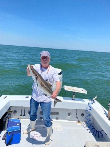
under Tropical Storm Watch...............................
Last track I saw this morning - comes up coast - gets to Cape Hatteras just shy of Norfolk turns east. Although I just saw on the news that the Navy is pulling out of it's Norfolk base & putting out to sea. Aircraft headed inland.
"Well, it's alright.
.............even if you're old and gray."
"Well, it's alright.
............you still got something to say."
.............even if you're old and gray."
"Well, it's alright.
............you still got something to say."
AdmiralOriginal Crew20,900 postsSince 2018
Macks/Capt13 - I'll wing past your properties Thursday/Friday (assuming that's possible) & give a looksee.
[URL unfurl="true"]https://weather.com/weather/today/l/b64ad36eb9a2319e0d14881e1a05fc79841b8d05b5414ac060e515dac0f91e34[/URL]
"Well, it's alright.
.............even if you're old and gray."
"Well, it's alright.
............you still got something to say."
.............even if you're old and gray."
"Well, it's alright.
............you still got something to say."
AdmiralOriginal Crew20,900 postsSince 2018

Looks like a slow moving Cat 1 if that at ground level In the Bahamas. Just talked to my buddy in Lauderdale and he said not much going on, intermittent winds around 20kt and rain.
If this is/was a Cat 5 you can expect the Bahamas to be completely destroyed.. nothing left but mud....
What? Grand Bahama and Abaco Islands got destroyed. Most damage I have ever seen in my life from a hurricane. The entire eastern side of Grand Bahamas and all of Abaco is leveled.
MateOriginal Crew160 postsSince 2019
whatever is left of this reaches me late Thursday extending into Friday night - weather.com is saying this right now
[TABLE]
[TR]
[TH][/TH]
[TH]UV INDEX[/TH]
[TH]SUNRISE[/TH]
[TH]SUNSET[/TH]
[TH]MOONRISE[/TH]
[TH]MOONSET[/TH]
[/TR]
[TR]
[TH][/TH]
[TH]UV INDEX[/TH]
[TH]SUNRISE[/TH]
[TH]SUNSET[/TH]
[TH]MOONRISE[/TH]
[TH]MOONSET[/TH]
[/TR]
[TR]
[TD]FRI
SEP 6[/TD]
[TD]Rain/Thunder/Wind[/TD]
[TD]76°64°[/TD]
[TD]90%[/TD]
[TD]NE 31 mph[/TD]
[TD]89%[/TD]
[/TR]
[TR]
[TD][/TD]
[TD]4 of 10[/TD]
[TD]6:36 am[/TD]
[TD]7:25 pm[/TD]
[TD]2:34 pm[/TD]
[TD]--[/TD]
[/TR]
[TR]
[TD][/TD]
[TD]Tropical storm conditions likely. Windy...showers and thundershowers in the morning, then cloudy skies with more rain likely in the afternoon. High 76F. Winds NE at 25 to 35 mph. Chance of rain 90%. 2 to 3 inches of rain expected.[/TD]
[TD][/TD]
[TD][/TD]
[TD][/TD]
[TD][/TD]
[/TR]
[TR]
[TD]FRI NIGHT
SEP 6[/TD]
[TD]Showers/Wind Early[/TD]
[TD]--64°[/TD]
[TD]60%[/TD]
[TD]NNW 28 mph[/TD]
[TD]89%[/TD]
[/TR]
[TR]
[TD][/TD]
[TD]0 of 10[/TD]
[TD]6:36 am[/TD]
[TD]7:25 pm[/TD]
[TD]2:34 pm[/TD]
[TD]--[/TD]
[/TR]
[TR]
[TD][/TD]
[TD]Windy. Some showers in the evening then partly cloudy overnight. Low 64F. Winds NNW at 25 to 35 mph. Chance of rain 60%.[/TD]
[TD][/TD]
[TD][/TD]
[TD][/TD]
[TD][/TD]
[/TR]
[/TABLE]
"Well, it's alright.
.............even if you're old and gray."
"Well, it's alright.
............you still got something to say."
.............even if you're old and gray."
"Well, it's alright.
............you still got something to say."
AdmiralOriginal Crew20,900 postsSince 2018
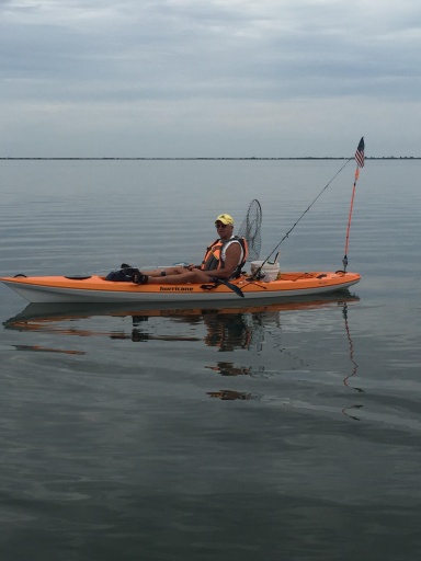
Al, what is your prognosis for Gabriela. (I know its a "bit" early, lol.)
Gabriel - there's another one coming????
"Well, it's alright.
.............even if you're old and gray."
"Well, it's alright.
............you still got something to say."
.............even if you're old and gray."
"Well, it's alright.
............you still got something to say."
AdmiralOriginal Crew20,900 postsSince 2018
Going to be some strong storms heading east on LI.?
CommodoreOriginal Crew5,902 postsSince 2018
Sign in to reply to this thread.
Thread
Weather