tides question, Great South Bay
774 views·17 replies·by pequa1
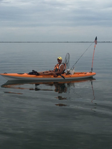
not sure how to word this but will try. When I docked in Lindenhurst in the 70s I used to look at tide charts for the two inlets but primarily Fire Is. Usually went to Snakehill so I looked up Fire Is Inlet tides. When I moved the boat in the 80s to Amityville I switched to fishing West Island and Sloop Channel so would look up Jones Inlet tides and continued to do so when I started trailering out of Massapequa in 97 or so. Now I just kayak locally and look up Amityville high tide times, but I know the incoming continues to flow through 'Pequa beyond that time. (Yes, I know the charts all say times approximate!) BUT WHERE ALONG THE SOUTH SHORE (BACKBAY) DOES ONE SEE THE "end" ? Bergen Point ? or is Bergen Pt only impacted by Fire Island Inlet tide ? Tanner Park, Copaigue ?
Every day is Saturday.
CommodoreOriginal Crew7,034 postsSince 2018
All approximate. We fish current. When we have high "tide" at Babylon Village, the "current" begins to go out at Fire Island Inlet. Approximately 45 minutes later, the current begins going out at the Coast Guard Station (Moses Bridge). Approximately, 1 hour and change after Babylon high tide, the current begins going out in West Channel and Snake Hill. An hour and a half, current begins going out at Frank & Dicks. This works for me. I use Babylon high tide for all my calculations. It also gives me the tide status for treading clams on the south side of the bay.
First Mate510 postsSince 2021
All approximate. We fish current. When we have high "tide" at Babylon Village, the "current" begins to go out at Fire Island Inlet. Approximately 45 minutes later, the current begins going out at the Coast Guard Station (Moses Bridge). Approximately, 1 hour and change after Babylon high tide, the current begins going out in West Channel and Snake Hill. An hour and a half, current begins going out at Frank & Dicks. This works for me. I use Babylon high tide for all my calculations. It also gives me the tide status for treading clams on the south side of the bay.
Every day is Saturday.
CommodoreOriginal Crew7,034 postsSince 2018

So I can infer that Jones Inlet tides and current do not impact Babylon. Yet Jones Inlet tides and current do impact Amityille and not tides and current from Fire Island Inlet. somewhere in the middle must be the answer to my query.
Having said that there is still no substitute for local knowledge and your own keen powers of observation to make the necessary adjustments in a specific area. There are locations in the Peconics I fish where regardless of the stage of the tide, current flow, and breeze, the drift always seems to take my boat in the exact opposite direction of what you would think. Eddy's caused by certain land formations, channels, etc. can set up their own distinct patterns that defy published data. The learning never stops if you pay attention.
Crabman's excellent comments are a true testimonial to that!
CaptainOriginal Crew1,853 postsSince 2018
Those who know me well or have heard me present on this topic understand I am a big proponent of the Eldridge Tide Pilot book. Of all the available sources of printed tide and current information I have always found its data to be the most accurate.
Having said that there is still no substitute for local knowledge and your own keen powers of observation to make the necessary adjustments in a specific area. There are locations in the Peconics I fish where regardless of the stage of the tide, current flow, and breeze, the drift always seems to take my boat in the exact opposite direction of what you would think. Eddy's caused by certain land formations, channels, etc. can set up their own distinct patterns that defy published data. The learning never stops if you pay attention.
Crabman's excellent comments are a true testimonial to that!
^^^^^^ Like he said, there are NO substitutes for local knowledge. Ask any competing sailboats for the early 80s Round Long Island Sailboat Race who were fighting a raging ebb tide in the Sound off of Petty's Bight, watching in rage another boat close to the shore seemingly with its engine on!!
Years of fishing there helped me learn that about 1 hour into the ebb, there was an east flowing back eddy in the bight, and sailboat owners loved to have a fisherman on board. That back eddy is not in Eldridge...
Shall I go to heaven or a-fishing? - H. D. Thoreau
Veni. Vidi. Cepi. - with apologies to Gaius Julius Caesar
Veni. Vidi. Cepi. - with apologies to Gaius Julius Caesar
AdmiralOriginal Crew21,717 postsSince 2018
Enjoying all the comments but where along the town of Babylon is "the spot" that is more influenced by the current and tide of one inlet over the other inlet?
Sounds like you need to have a more in-depth conversation with Crabman.
CaptainOriginal Crew1,853 postsSince 2018
Sorry I cannot be of more help in your specific area, Pequa. I have very limited local knowledge of the area where you fish.
Sounds like you need to have a more in-depth conversation with Crabman.
Every day is Saturday.
CommodoreOriginal Crew7,034 postsSince 2018
So I can infer that Jones Inlet tides and current do not impact Babylon. Yet Jones Inlet tides and current do impact Amityille and not tides and current from Fire Island Inlet. somewhere in the middle must be the answer to my query.
First Mate510 postsSince 2021
I'm happy if it helps. It's confusing. Just take a day and start your fishing as the out going tide at Jones Inlet starts. Find a high tide table that is the same time as the out going current and use that table. I have a great app on my phone, Tides Near Me. I just looked, the Babylon High Tide is within nine minutes as Amityville High Tide. That has no relationship to when the current begins to go out at Jones. You will just have to see. The time has to do with distance from the inlet. I'm lucky that I'm in Babylon. The Babylon High Tide just happens to be the right distance from the inlet for the current to begin going out. So, the calculations are easy.
First Mate510 postsSince 2021
I use Tides Near Me also. I need to see if I can find a “spot” in lindenhurst to see the difference from amityville to try to determine how much longer an incoming will flow past a massapequa location at “high tide”
Every day is Saturday.
CommodoreOriginal Crew7,034 postsSince 2018
Too hot and windy for me for kayakfishing so I thought I would "play" with this. What a disaster. NOAA, Tides for Me and Tideschart,com not only have different times, but one, Tidecharts, lists the same high tide times for Massapequa, Amityville, and Copaigue! Lindenhurst is an hour different so maybe that is using Fire Island Inlet ?? Of course the geographic location of the tide "stations" matters, and one system uses a spot for a station a mile up a canal in Matzohpizza, right off Merrick Road, for the "Biltmore Shores, Massapequa" station. I only got interested in this when trying to figure how far to drift with one tide, and return after slack to go back. When one kayakfishes in one's mid 70s, constant paddling against the current to keep returning to a "good spot" gets old. (so...when the bite stinks, long drifts.)
Every day is Saturday.
CommodoreOriginal Crew7,034 postsSince 2018
@Crabman You sure are a wealth of information!
First Mate510 postsSince 2021
Pequa1, I stick to one table app and just work off that one. Tides Near Me. I don't think it matters which inlet. (I could be wrong). Tides Near Me does not seem to have a Lindenhurst tide station. Are you sure you are looking at Lindenhurst, NY? The high tide of all your mentioned locations should be within minutes of each other.
First Mate510 postsSince 2021
No, it was tideschart.com that had Lindenhurst. I agree, I will just use Tides Near Me and add another fifteen minutes or so for the Copaigue Hole or maybe Tanner Park. That way, I should be able to figure just how long I will be in Massapequa waters before the current goes slack, and I can start drifting the other way.
Every day is Saturday.
CommodoreOriginal Crew7,034 postsSince 2018
Sign in to reply to this thread.
Thread
tides question, Great South Bay